The Best Hikes in NB Parks
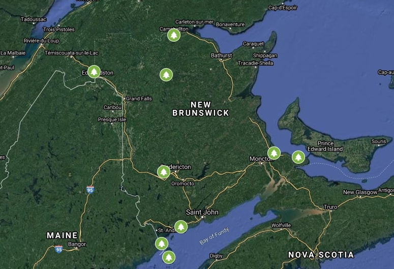
New Brunswick has nine diverse Provincial Parks representing most of what the province has to offer. Mount Carleton and Sugarloaf Parks offer the wilderness mountains and lakes experience. Parlee Beach and Murray Beach Parks offer a sandy beach experience. New River Beach, The Anchorage and Herring Cove Parks provide various experiences of the world’s highest tides in the Bay of Fundy. Mactaquac Provincial Park provides an oasis from the city life with its forested trails around beaver ponds and streams, and it’s beach on the Saint John River. There is even a botanical garden at the République Provincial Park.
Each park has its own character and each trail within the parks is unique. Hiking on the trails is the best way to connect with the beautiful landscapes, learn about the history of each park, and meet some of the plants and animals that call these parks home. The following is our recommendations for the trail in each park that will provide you with the best introduction to the character of that park.
1. République Park – Botanical Gardens
Trail Difficulty: Easy
Trail Length: 1.5 km
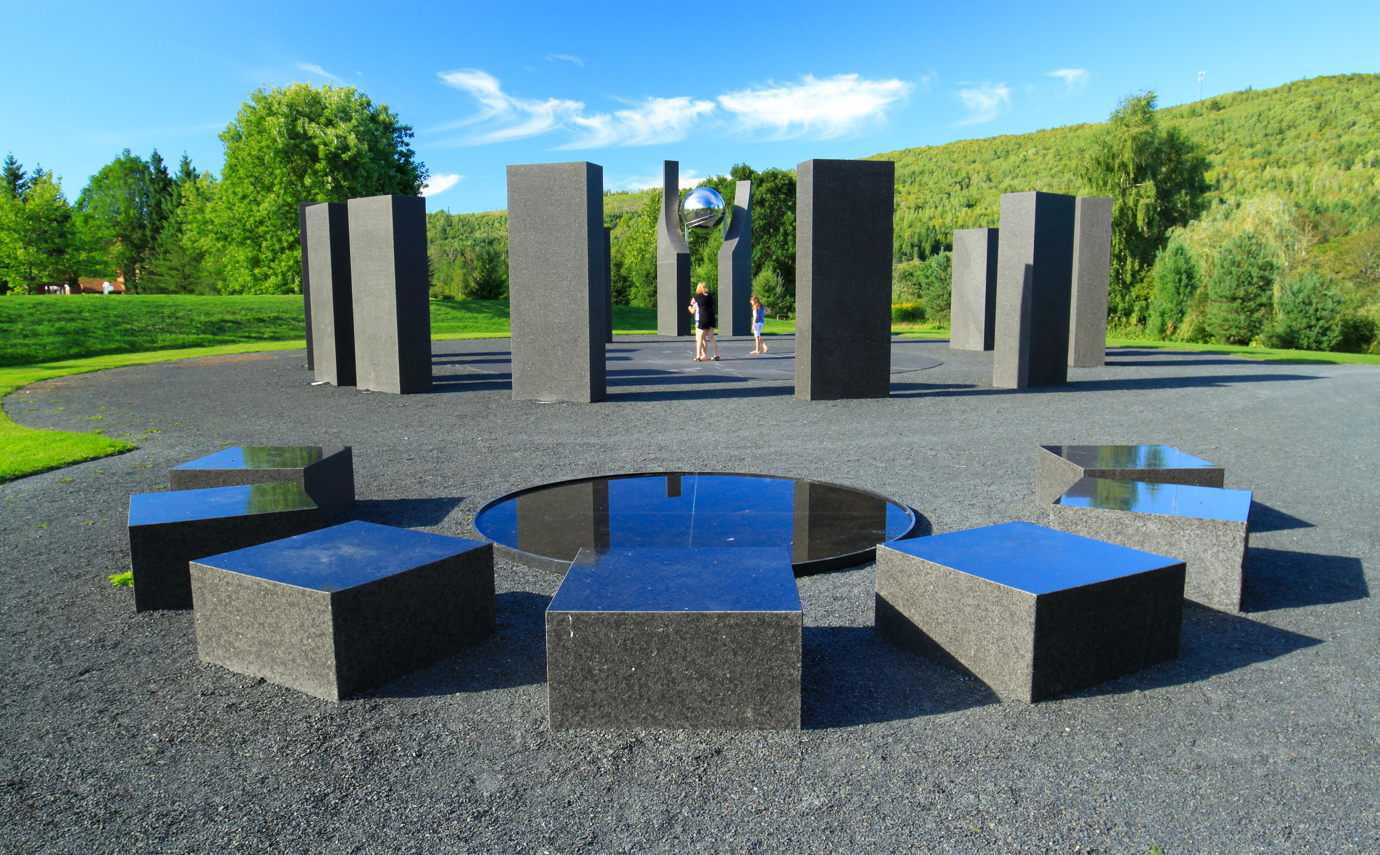
The Trans Canada Trail travels through the Edmundston river valley on its way to Quebec. The trail passes by République Provincial Park nestled between the hills surrounding the Madawaska River Valley. The park has the largest botanical garden east of Montreal along with a campground. This combination makes it a great place for a camping adventure. The botanical garden is an amazing place to take a walk with interesting things to explore around every corner. When you first enter the botanical garden you will be greeted by a 10 foot waterfall flowing into a pond. Turn right or turn left to explore the many bushes and flowers along the trail. One trail leads up to the top of the waterfall providing views of the surrounding park.
Along the trails you will find hedges in the shapes of animals and people, and strange sculptures that are made at a workshop overlooking the Madawaska River. There is a large, Stonehenge type exhibit called Kronos made out of 20 foot high black granite columns with a large, shiny, silver sphere as the focal point. You will also pass by a twisted house that looks like something out of a cartoon. Make sure you slow down and enjoy the many details of this park. This is not your typical hiking destination but you won’t be disappointed.
2. Murray Beach Park – Beach Hike
Trail Difficulty: Easy-Moderate
Trail Length: 1.3 km one way
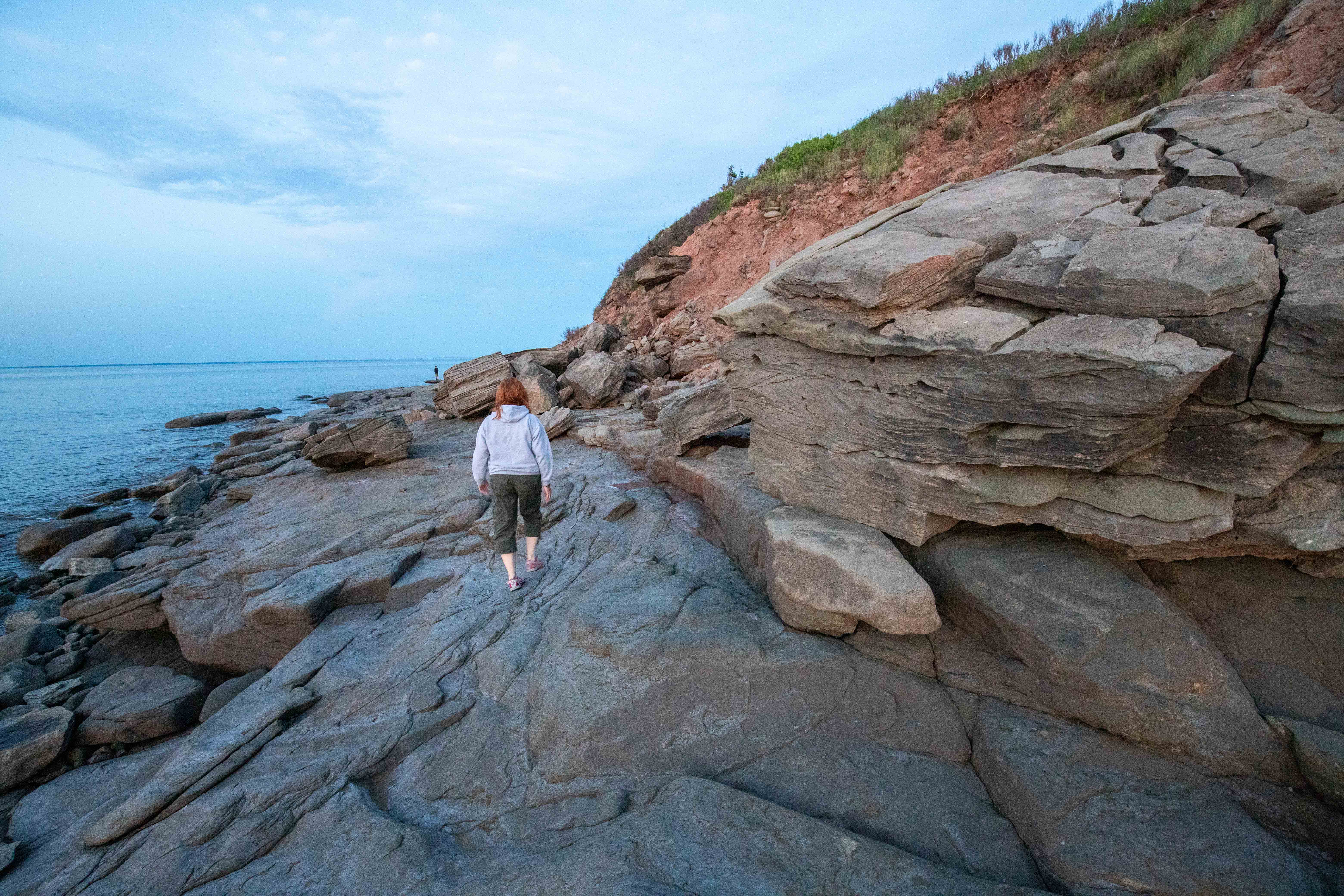
Murray Beach Provincial Park is one of the lesser known parks in the province and that’s what gives it its character. This park is mainly used for camping but it also has several parts to explore. The main part is Murray Beach. The sandy part of the beach is one kilometre in length which is great for swimming.
If you are taking a walk I would suggest turning right on the beach until you come to the high, eroding cliffs. There are large sandstone boulders that are being exposed by the erosion of the red dirt cliffs. In places the flat gray sandstone makes an excellent walking surface. In other places you will need to rock hop. Be careful not to step on the thousands of snails on the rocks at low tide. Once you get around the corner you should be able to see the Confederation Bridge to Prince Edward Island in the distance.
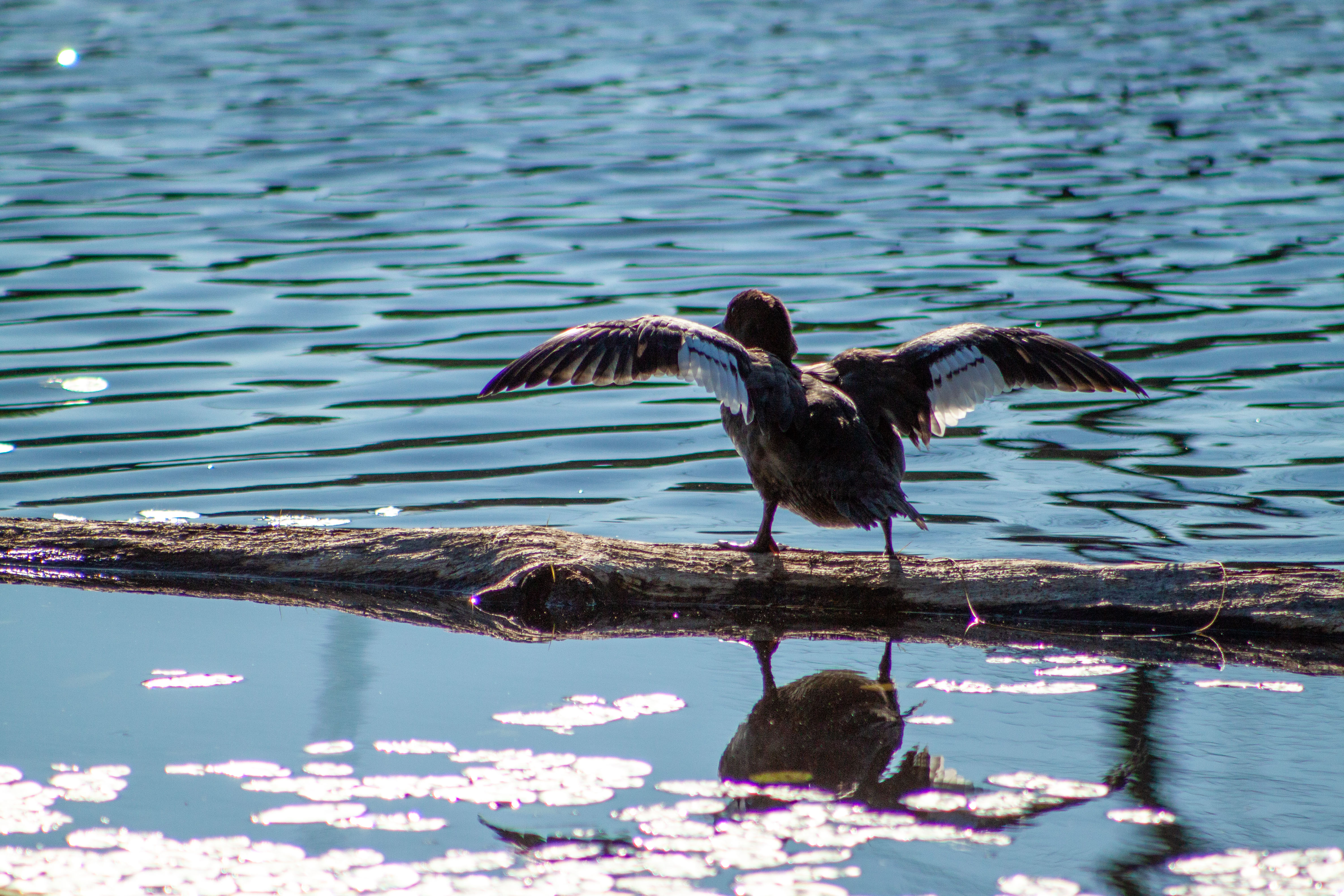
Make sure you look closely at the water. You may see ducks floating offshore. Keep an eye on the tides. At high tide there will be less options for paths back to the main beach.
3. Herring Cove Park – Herring Cove Beach Hike
Trail Difficulty: Easy
Trail Length: 1.8 km One Way
Herring Cove Provincial Park on Campobello Island has a campground, golf course, and hiking trails. The trails explore the coastline, have some interesting geology and ecology, and travel through the forest and through history. The Roosevelts used to take the Carriage Road (now a hiking trail) from their home to a cottage at Herring Cove.
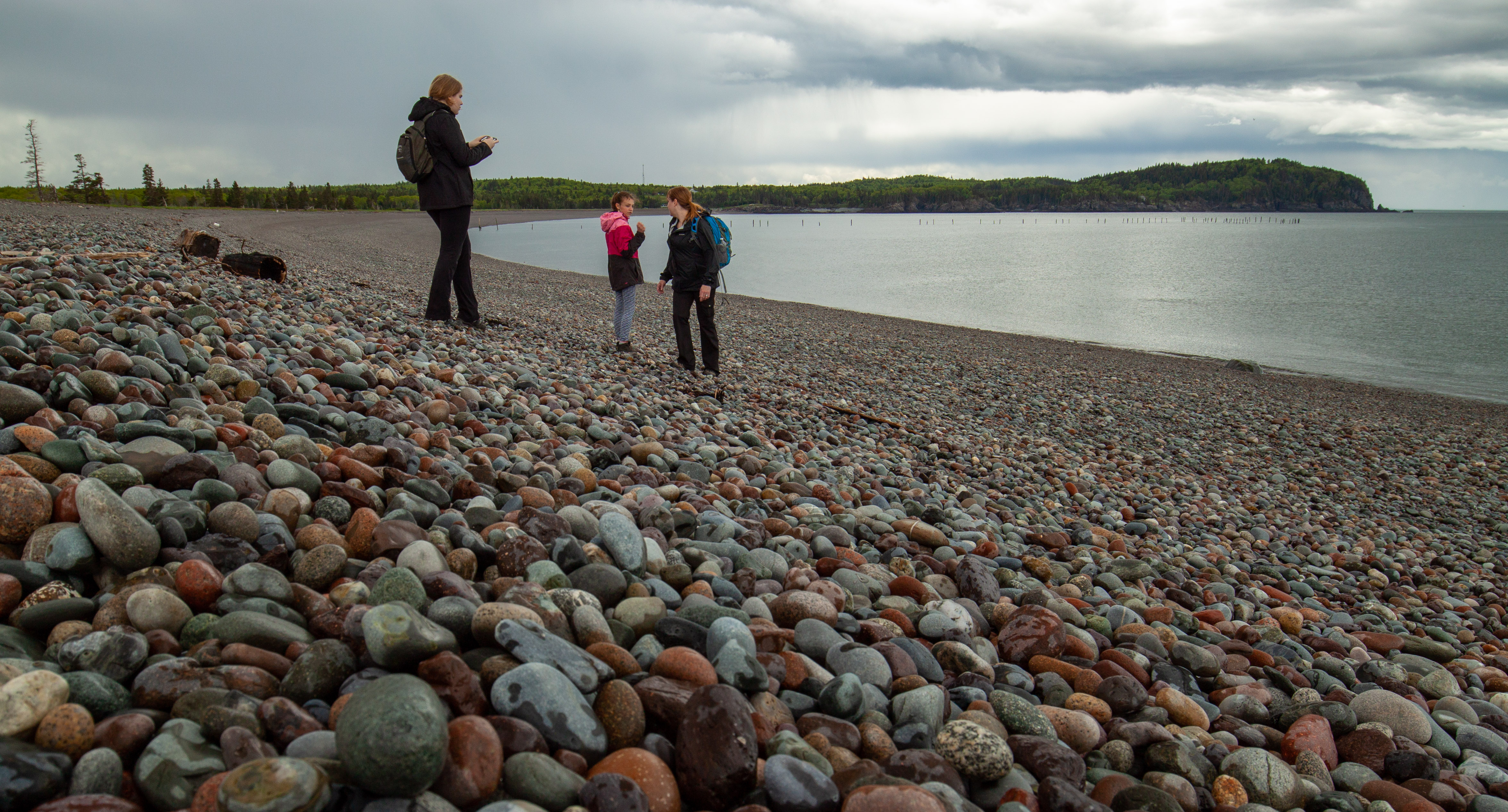
Herring Cove Park got its name from Herring Cove, a long, sweeping cobblestone beach. The rocks on the beach are quite dark, making it visually striking. The beach is steep so you can explore down by the water in one direction and return at the top of the beach for a different view. At the top of the beach you will get views of Lake Glensevern, a long narrow lake that separates the beach from the forest. The Roosevelts cottage was on this small lake. Make sure you stop and listen to the waves. They push the small, round rocks up the beach and the rocks tumble back down making an interesting clacking sound.
4. Anchorage Park – Anchorage Beach Hike
Trail Difficulty: easy-moderate
Trail Length: 4.3 km One Way
The Anchorage Provincial Park is another provincial park on one of the Fundy Isles. This park is on Grand Manan Island, which is the largest of the Fundy Islands and a hikers paradise. The island is geologically split down the middle. The volcanic origins on the west side of the island create high dark cliffs, while the east of the island is much
older and more of a lowlands with sandy beaches. Anchorage beach is the largest of these beaches, which makes it the most interesting place to take a walk.
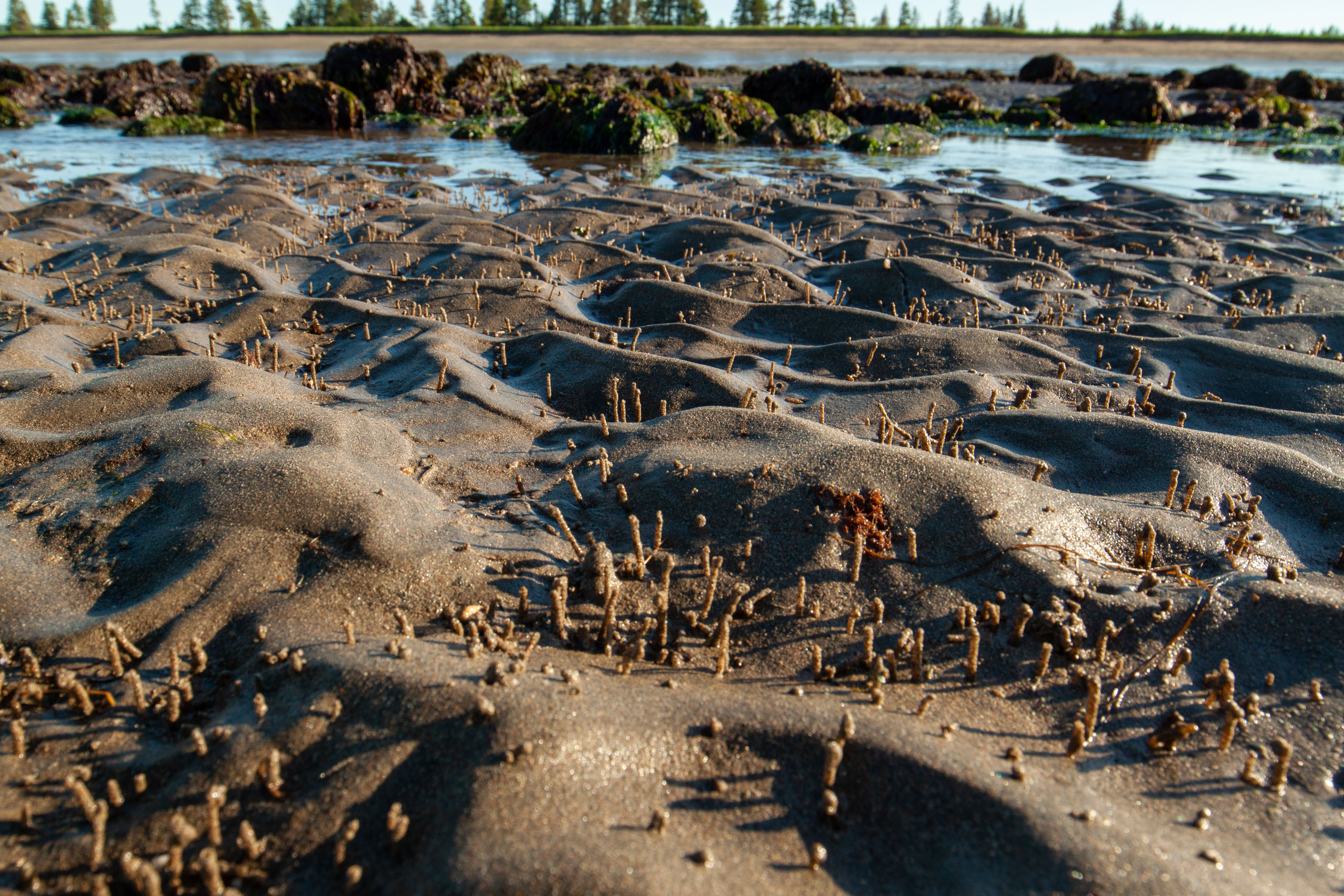
You can access the beach from the main entrance on Long Pond Road. The road ends at the beach. To the left (east) is a long, sandy beach. To the right (west) is mostly rocky outcrops that make it an interesting place to explore. From the beach you can see several islands. On the sandy part of the beach at low tide make sure you look for the thousands of small sand chimneys rising up from the beach. These are created by clams under the sand.
If you walk all the way Oxhead Point on the sandy part of the beach you have the option to return on the Oxhead Trail that travels through the grass along the top of the beach. This trail passes by Great Pond and Long Pond that are usually full of waterfowl. If you rock hop all the way to Red Point on the rocky part of the beach you can return on the Red Point Trail that is mostly a boardwalk that travels along the clifftops overlooking the beach below.
5. Parlee Beach Park – Beach Hike
Trail Difficulty: Easy
Trail Length: 2.1 km One Way
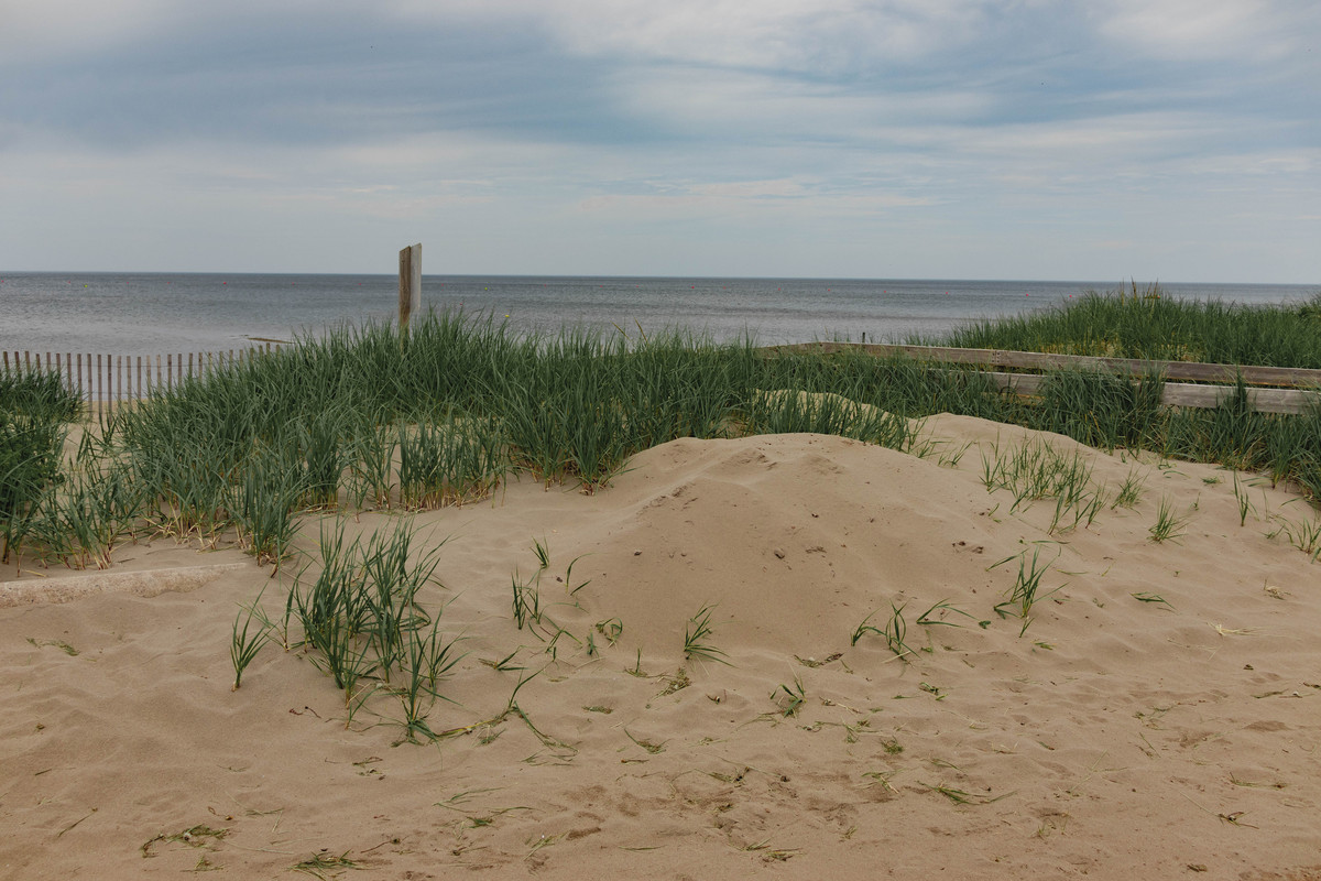
Parlee Beach in Shediac is the most popular beach in the province. Its proximity to Moncton and easy access makes it a favorite place for anyone looking to get out of the city for a while. From the sandy beach you can see Shediac Island in the mouth of Shediac Bay. To the left (west) the beach ends at a sandy point next to a stream that separates the beach from a residential area. Behind the dune is a large grassy area with a small pond where you can find all sorts of waterfowl. To the right (east) the beach ends at a larger stream that comes from an inner bay that is usually filled with waterfowl. Make sure you try swimming at the beach before you go. What better way to end off a hike, than with a quick swim in the cool saltwater.
6. New River Beach Park – Barnaby Head Trail
Trail Difficulty: Moderate
Trail Length: 2.7 km Loop (plus 1.9 km loop access trail)
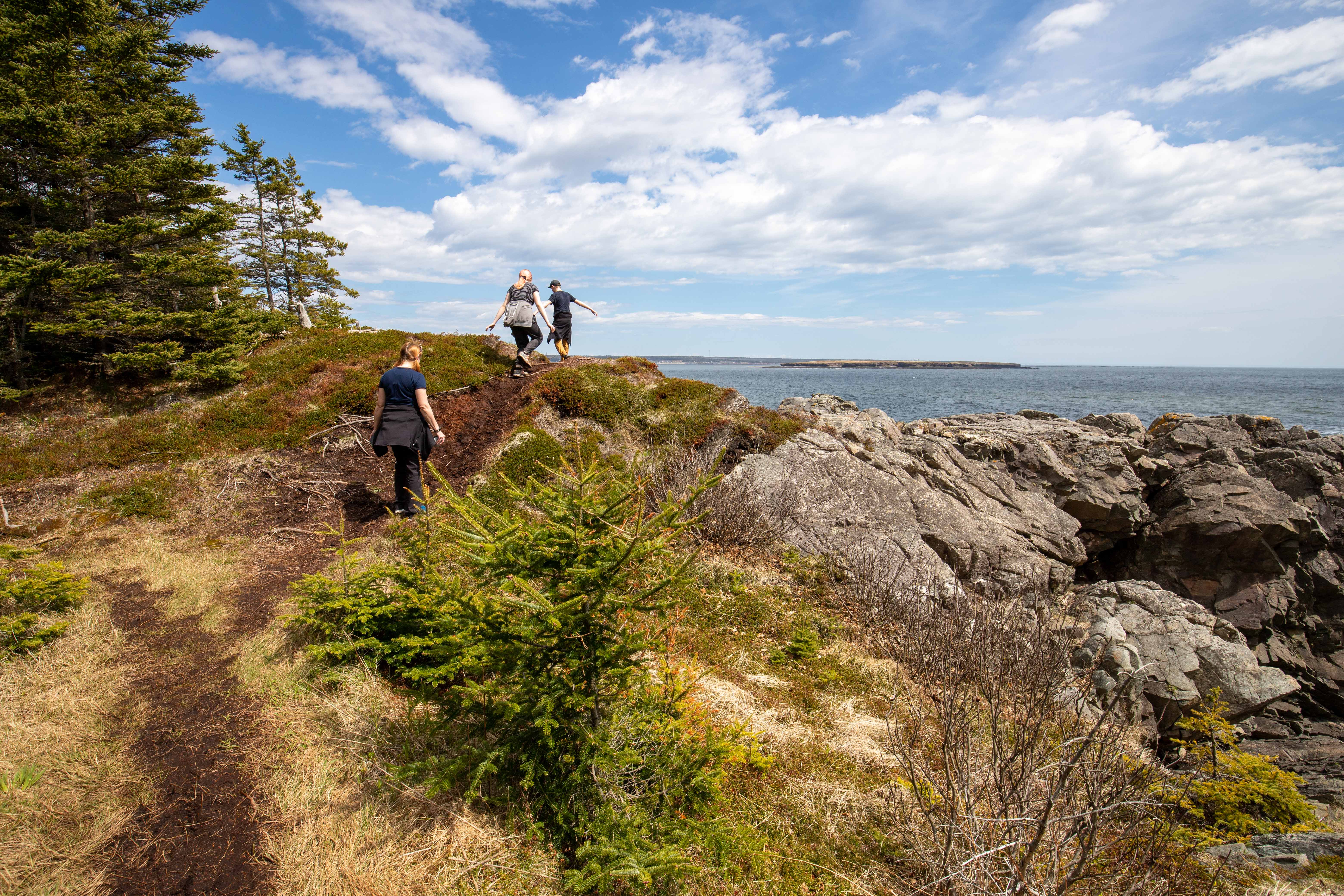
Back to the Bay of Fundy for a different type of coastal adventure. New River Beach is known for its sandy beach that gets expansive at low tide. The beach walk is a must but the real hiking adventure is on the trails out on the peninsula to the east of the beach. There are two trails on the Peninsula: Chittick’s Beach and the Barnaby Head Trail. The Barnaby Head Trail is our favorite but you have to hike the Chittick’s Beach Trail to get there. The two trails are progressive loops.
Both trails follow along the rugged coast of the peninsula and are interspersed with gravel beaches. The Barnaby Head Trail starts at Chittick’s Beach, one of the largest gravel beaches. At the beach there is a sign about settlers that used to live here. The sign describes their many hardships trying to survive in this rugged landscape.
The Barnaby Head Trail passes by one more gravel beach before going around the rocky point of the peninsula. There are several lookouts and lookout platforms that provide spectacular views of the rocky shoreline and the Bay of Fundy. On a clear day you can look across and see the Point Lepreau Nuclear Plant in the distance.
The trail returns on a narrow boardwalk through a large bog. Here you will find lots of pitcher plants and sundews. Both plants are interesting because they are carnivorous and survive on a diet of flies and other bugs.
Once you get back to Chittick’s Beach you can return to the parking lot through the woods on the back side of the loop.
7. Mactaquac Park – Beaver Pond Trail
Trail Difficulty: Easy
Trail Length: 900 Metres
The trails at Mactaquac Provincial Park mostly travel along streams and beaver ponds. The centerpiece of these trails is the Beaver Pond Trail. This relatively flat, crushed rock trail travels around a beaver pond showing the habitat caused by the pond. There are many dead trees in the pond that were flooded when the pond formed. There are many interpretive signs explaining the surrounding habitats. At the back of the loop there is a long boardwalk that crosses a narrow part of the pond. From here you can continue on other trails to larger beaver ponds or return through the woods just above the pond. Make sure you pack a picnic. There is a shelter and picnic table on a hill by the parking lot that overlooks the pond.
8. Sugarloaf Park – Sugarloaf Mountain Trail
Trail Difficulty: Difficult
Trail Length: 700 Metres (plus a 2 km access trail)
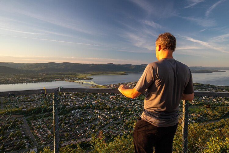
As you drive into Campbellton in the north of the province you will first see Sugarloaf Mountain rising sharply from the surrounding landscape. It’s the kind of mountain that you just know is going to have a great hiking trail and it does. Enter the park and use the Terry Fox Trail to access the Sugarloaf Mountain Trail. The Terry Fox Trail is a wide, crushed rock trail that circles the
The Sugarloaf Mountain Trail steeply climb the mountain from the start. It follows a ridge on the east side of the mount. At about the half way point you will be greeted with a lookout on the right providing a glimpse of what’s to come. There are also several views off the back of the mountain of the forests and hills in the park. The main hill on to the right is an alpine ski hill. This makes it an excellent park to visit in both the summer and the winter months.
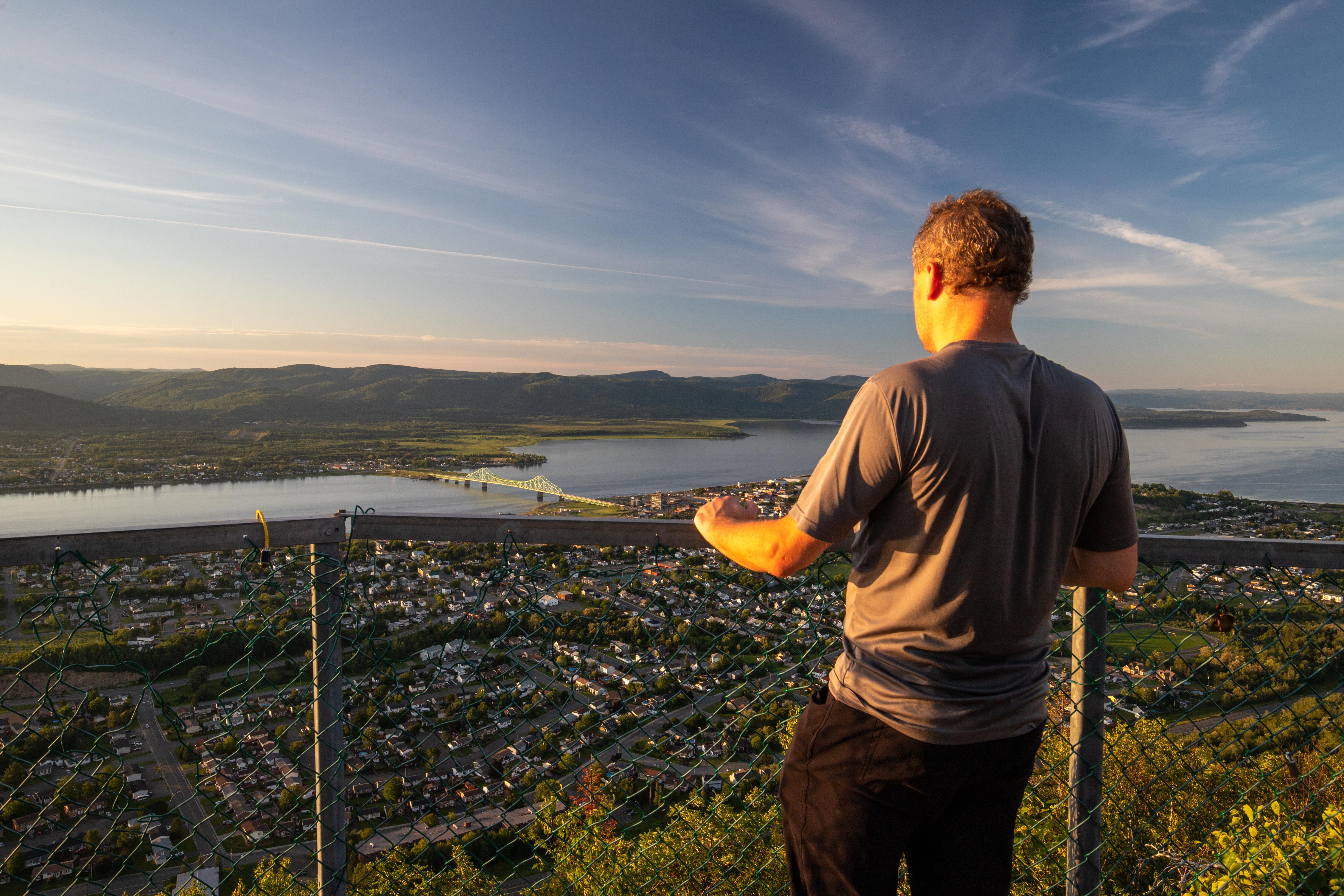
The trail up the mountain gets progressively steeper. There are old cement steps and in one especially difficult section there is an angled steel ladder with railings to help with the climb. Once at the top you will come out to the most amazing view of Campbellton, the Restigouche River, Chaleur Bay and the Gaspé Peninsula in Quebec across the valley. A steel lookout platform in the shape of a T allows you to walk out above the cliff face so you have unobstructed views. The steep climb is short and well worth it for one of the most amazing views in the province.
9. Mount Carleton Park – Mount Carleton Peak Trail
Trail Difficulty: difficult
Trail Length: 9.4 km
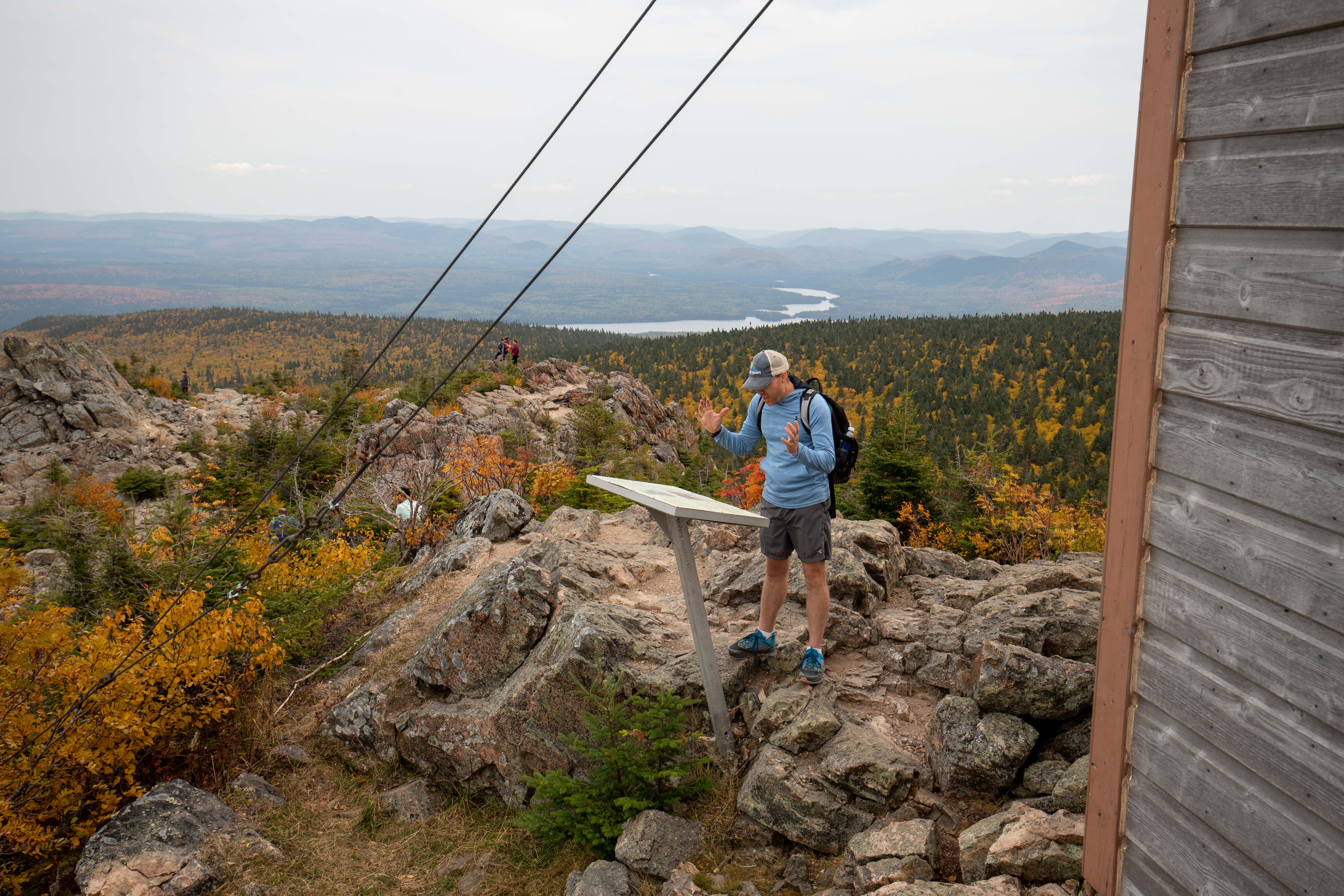
If you like mountains you will love Mount Carleton Provincial Park. The park is host to several large mountains. The highest is Mount Carleton, which is the highest peak in all of Atlantic Canada at 820 metres (2,690 feet). The hike to the peak is a must do if you are going to visit this remote wilderness park. The Mount Carleton Peak Trail is a loop. The best way to hike the mountain is clockwise. The trail starts by traveling through the hardwood forest at the base of the mountain. It soon comes to Mamozekal Brook, a clear, mossy stream that comes from the top of mountain. The trail climbs the mountain next to the brook until it come to the Headwaters campsites. These backcountry campsites are ideal for anyone wanting to experience the mountains in a more intimate way.
The trail then climbs up on the rocky, exposed ridge that leads to the iconic fire tower at the peak. Climbing up and across the ridge is a bit of a scramble. As you scramble across the ridge you will get amazing views of the fire tower and the surrounding forest and lakes. On the left (north) you will see the Mount Carleton Plateau with the peaks of Mount Sagamook and Mount Head poking up in the distance.
On the way down the mountain make sure you take a break at the small cabin. Learn about the lives of the men who stayed in this cabin when they weren’t working at the fire tower at the peak.
New Brunswick Provincial Parks are diverse and each has its own character. I suggest you take the time to explore each and every one of them. Exploring them on foot is a great way to connect with each of the parks and to the province of New Brunswick as a whole.