Hidden Gem Hikes in NB Provincial Parks
When visiting parks, people often want to hike the most popular trail in the park. Sometimes the most popular trail is even named after the park, like at Mount Carleton or Sugarloaf. These types of trails get a lot of attention and are
usually seen on the brochures and advertisements. These trails are amazing but because of their popularity, they get more than their fair share of foot traffic.
Vicki and I have found that the second or third most popular hikes are usually just as nice with a lot less people. Sometimes they are even better!
New Brunswick Provincial Parks have many options for hiking trails. If you have already hiked the most popular trail in a park, or you are just looking for a less busy trail, here are our recommendations for the trails to check out. If you haven’t yet checked out the most popular trails in each park you can read about our recommendations for popular trails> here.
- République Park – Petit-Témis (Trans Canada Trail)
Trail Difficulty : easy
Trail Length : 144 km
The République Park in Edmundston has a campground, Botanical Garden , and even a historic car museum. The park is nestled along a bend in the Madawaska River. If you have walked around the campground and Botanical Gardens and wanted to take a longer walk, check out the Trans Canada Trail. This wide, crushed rock trail runs along the entrance to the park. If you come out of the park and turn right you can walk all the way to Vancouver. If you turn left you can walk all the way (with the help of a ferry) to St. John’s Newfoundland. You may want to start small and explore the Madawaska River Valley first.
This section of the Trans Canada Trail is also part of the Meruimticook Trail . This 50 kilometre trail starts in Edmundston, travels through the Madawaska River Valley, and then heads southwest through the forest to Baker Lake.
- Murray Beach Park – Perimeter Trail
Trail Difficulty : easy
Trail Length : 2 km
Murray Beach Park is a beach and a campground. Most people don’t know that there is also a trail around the outside edge of the park. The Perimeter Trail is a 2 kilometre trail that travels along the cliff tops of the beach. At the end of the park road the trail cuts across the field and hugs the treeline at the edge of the park. The trail goes between two strips of planted red pine making it easy to follow.
The trail cuts through a small strip of woods keeping along the edge of the park. The trail then enters a patch of mixed forest and takes large sweeping turns through the trees. The trail crosses the park road near the entrance and then enters another patch of forest, continuing along the other side of the park. You will soon be once again in between the strips of red pines as you travel along the back of some cabins. Eventually you will come out on the clifftops at the high point in the park. From here you will cross the field along the clifftops until you return to the park road. If you haven’t already done so you should check out the beach , which can be accessed on the right.
- Herring Cove Park – Rock of Gibralter Trail
Trail Difficulty : easy
Trail Length : 1.9 km one-way
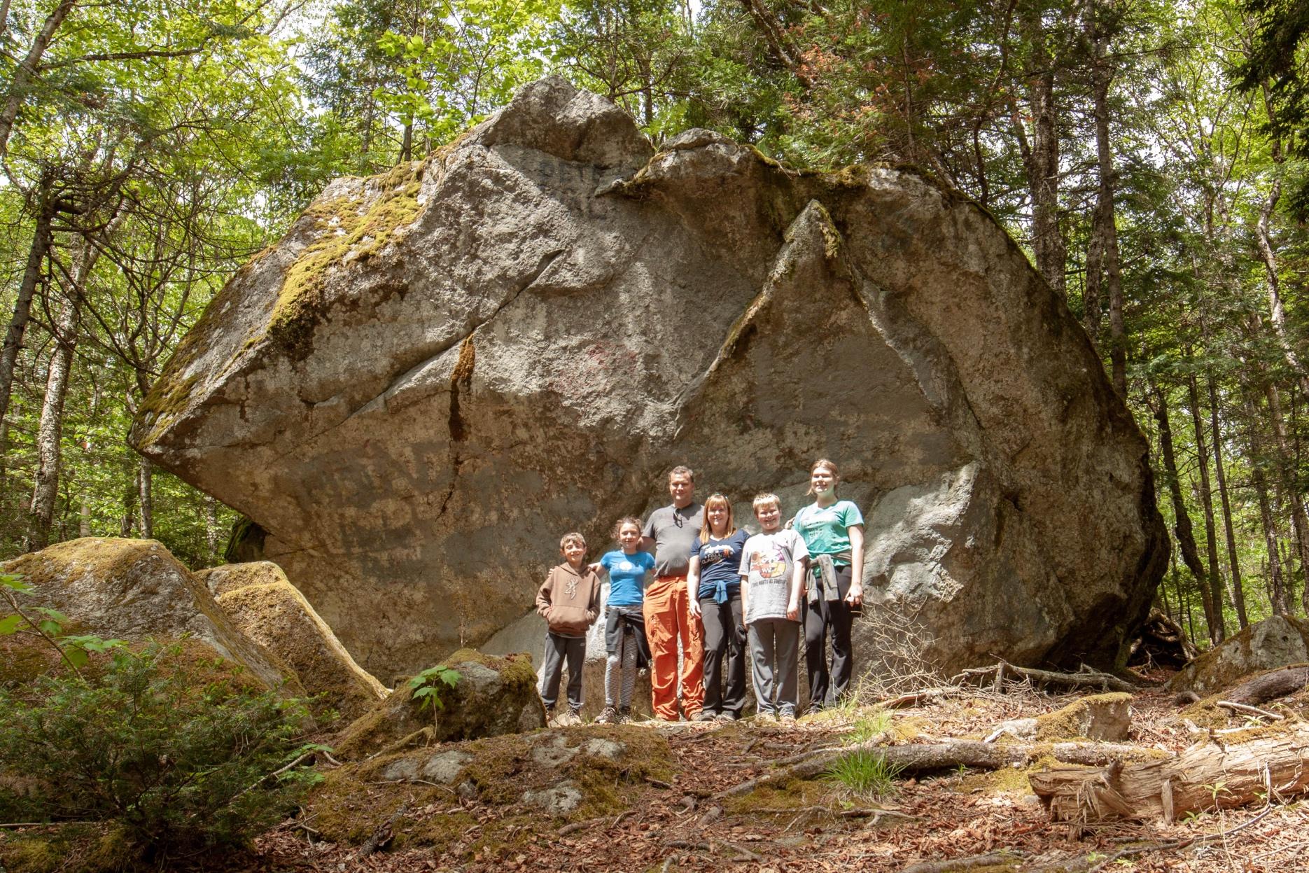
Lake Glensevern is a long narrow lake between Herring Cove Beach and the forest. Lake Glensevern is separated from the Bay of Fundy by only the steep beach and a small strip of bushes. The Rock of Gibraltar Trail is a trail that goes through the forest behind the lake. The trail comes out to the edge of the lake several times. At the second access point you will find an interpretive sign. The sign marks the spot where there used to be a Tea House overlooking the lake. There was also a bridge that crossed the lake providing direct access to the beach. The Roosevelt family (including President Franklin Delano Roosevelt) came here often to canoe and swim.
After you are done imagining what it would have been like to hang out at the tea house with the Roosevelts, you can continue on the trail and find out where it got its name. Erratics are large boulders that were picked up and carried by glaciers during the last ice age. At the end of the ice age when the glaciers melted they left these large boulders far from where they began. On the trail you will soon come to “Gibraltar Rocks”. Large boulders that were carried here from the New Brunswick Highlands. The largest boulder is about 15 feet high! The rocks that make up Herring Cove Beach were also left by the glaciers.
The rest of the trail follows some boardwalks through wet, mossy areas and then through a hardwood forest before emerging onto Glensevern Road. Turn left and you will soon be at the end of Herring Cove Beach. Return on the beach to make it a loop.
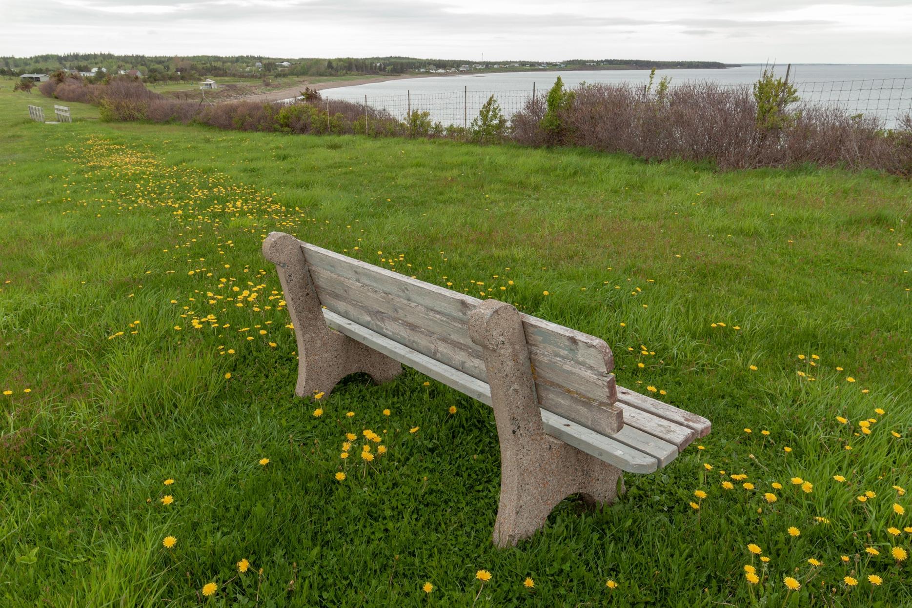
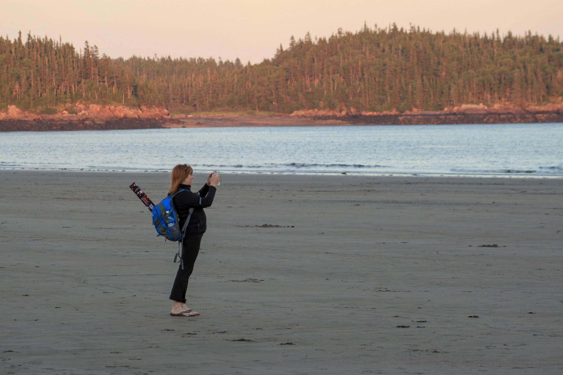
- Anchorage Park – Red Point Trail
Trail Difficulty : easy
Trail Length : 2 km
Anchorage Beach is the centre point of Anchorage Provincial Park . There are also several trails in the park, the longest being the Red Point Trail . This wide, grassy trail starts by passing a monument to fishermen who have lost their lives at sea. The monument is on a cliff overlooking the beach below. The trail passes through a small field with the outline of an old basement and then enters the woods. From here the trail is mostly a boardwalk that can be slippery when wet. Roofing shingles are nailed to the narrow boardwalk to provide grip. If you are staying at the park campground you can access this trail with a short side trail.
There are several lookout platforms and interpretive signs along the trail over the beach, the Bay of Fundy, and the smaller islands offshore. If you read the interpretive signs you will learn about the history and ecology of the area. When you get tired you can take a rest on one of the unique benches that look life lobster traps.
Eventually the trail comes out to the parking lot at the end of the Red Point Road. Nearby there is another interpretive sign near a survey pillar. There is also a trail that provides access down to the beach which is a great way to make a loop back to the start of the trail.
- Parlee Beach Park – Pointe-du-Chêne Road to Parlee Beach
Trail Difficulty : easy
Trail Length : 2.8 km
Parlee Beach is probably the most popular beach in the province and a great place to take a walk. If you get too much sun at the beach you may want to take a break and go for a walk in the woods. The Pointe-du-Chêne Road to Parlee Beach Trail is a wide crushed rock trail that will take you in a large loop through a mostly hardwood forest.
Just before you come to the parking lots at the beach you will find a long field on the right. A trail enters the woods at the back of this field near the middle. The trail crosses the beach access road and Pointe-du-Chêne road several times.
At the far end of the loop there is a trail that extends to the Downtown to Pointe-du-Chêne Trail . From here you can turn right turn right on this old rail bed trail and soon come to a small bridge crossing South Cove. This bridge provides a great view of the inner Shediac Bay. If you turn left on the Downtown to Pointe-du-Chêne Trail the trail will take you into Shediac.
- New River Beach Park – Beach Hike
Trail Difficulty : easy
Trail Length : 1.6 km one-way
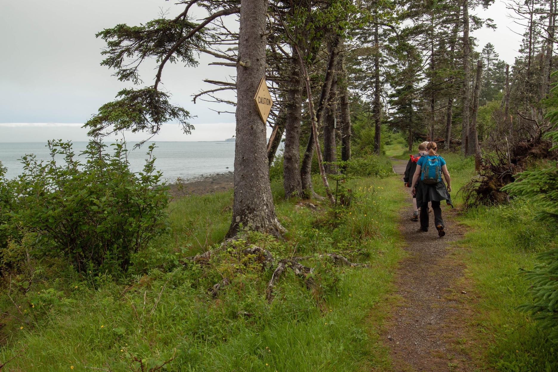
When people go to New River Beach to hike they usually bring back pictures of the rugged coastline at Barnaby Head or Chitticks Beach . For another option I suggest you take a walk on the beach and explore.
At high tide the beach is quite narrow, but at low tide the beach is expansive so try to plan your explorations at low tide. The beach is one of the few large sandy beaches on the Bay of Fundy. The first thing you will notice is New River Island off shore. If you look to the left you will notice the rugged coastline that takes you out to Chitticks Beach and Barnaby Head.
If you turn right and go to the end of the beach you will find many interesting rocky outcrops poking up through the sand. Be careful because the rocks might be slippery. In the small ponds caused by the rocks you will find all sorts of critters. Look up on the cliffs overlooking the beach and you will see several unique cottages. Our favorite is the one with the curved roof.
- Mactaquac Park – Little Mactaquac Stream Trail
Trail Difficulty : easy
Trail Length : 2.3 km
If you drive through Mactaquac Park you will see a large sign for the Beaver Pond . Around the beaver pond is a crushed rock trail with a boardwalk at the end. This is the most popular trail in the park and is great for all ability levels, and for learning about the beavers that shape this park. There are other trails that extend from the beaver pond and travel around even larger beaver ponds.
Another trail that starts at the beaver pond is the Little Mactaquac Trail . This loop trail travels through the woods on boardwalks along a small pond. The trail then travels through a mixed-wood forest before coming to a beautiful, rocky stream. It’s the kind of place that you just want to sit and enjoy. Just across a bridge you will find a shelter and a campsite beside the stream. The perfect place to sit and unwind.
The trail follows the stream for a bit before a bridge takes you back across and then the trail travels through a mostly softwood forest on what looks like an old road.
This trail gives you a wilderness walk in the park that isn’t associated with the beavers.

- Sugarloaf Park – Prichard Lake Trail
Trail Difficulty : moderate
Trail Length : 4.1 km (plus 2.6 km access trail)
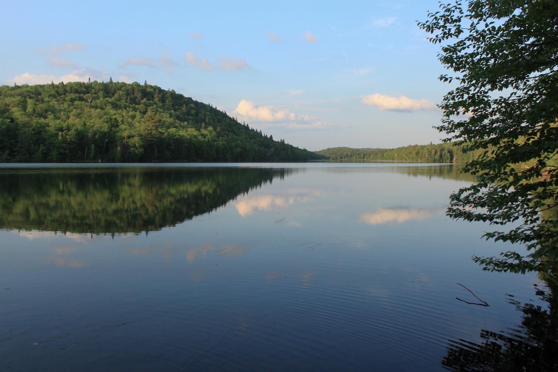
Sugarloaf Provincial Park is named after Sugarloaf Mountain , a mountain that rises sharply up from the surrounding landscape and is visible from a distance as you drive into Campbellton . Sugarloaf Mountain and the alpine ski hill behind it are usually what people think of when they think about the park. In the shadow of the mountain there is a trail network that travels through the woods behind the ski hill. Some of these trails are old roads that are used for cross country skiing. There is one trail that takes you to a beautiful place deep in the woods.
Not only is Prichard Lake a beautiful place to explore but it also has a rich history. At the end of the long narrow lake, there used to be a homestead. The Prichards, who owned the homestead, used to offer trout fishing to wealthy Americans when the salmon fishing on the Restigouche river was poor. Today a grave in a small field is all that’s left of the homestead. The trail around the lake follows the shoreline offering many views. At the far end of the lake is a dam keeping the water levels constant. Today the lake is a water source for the city of Campbellton.
- Mount Carleton Park – Dry Brook Trail
Trail Difficulty : strenuous
Trail Length : 5.8 km one-way
Mount Carleton Peak is the highest peak in Atlantic Canada. It has a rocky ridge that leads to a historic fire tower at the peak. From the fire tower you can see trees and lakes in every direction. That makes it the most hiked trail at Mount Carleton Provincial Park .
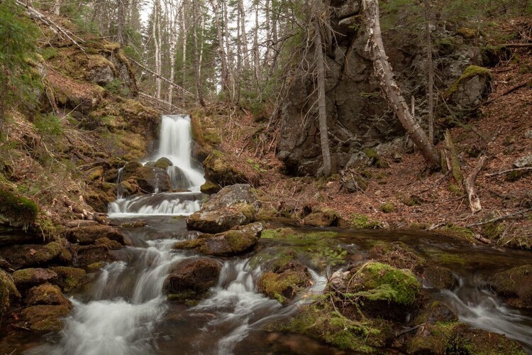
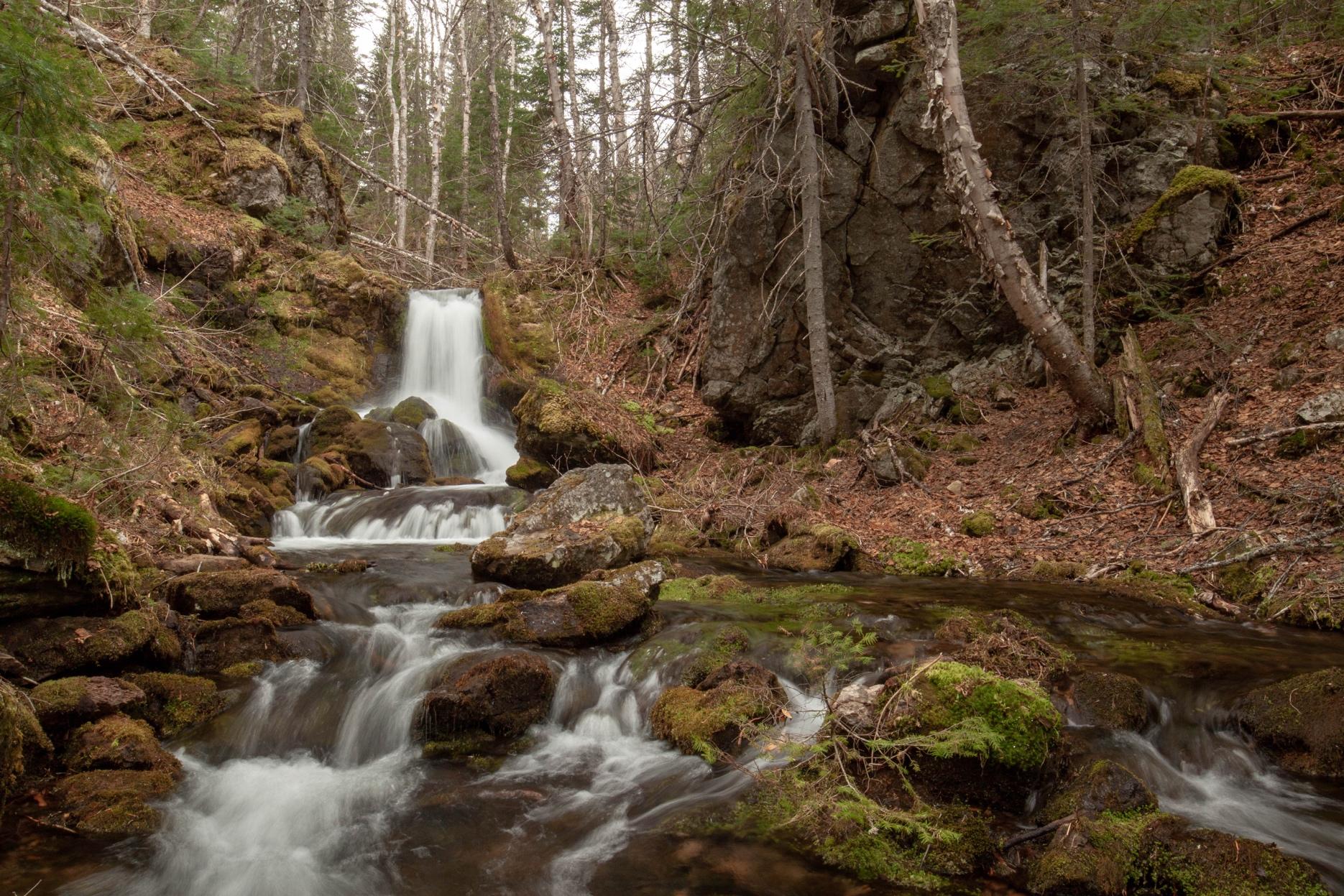
One of the lesser known trails in the park is the Dry Brook Trail . It provides access to Mount Carleton Peak but from the other side of the mountain. The trails on this side of the mountain are some of the least popular in the park. That’s why I was surprised when I finally hiked the Dry Brook Trail. The trail starts at a small field by Bathurst Lake. It’s fairly flat for a while but then enters a steep sided valley where there are several waterfalls as the stream tumbles down from the plateau through the mossy rocks. The waterfalls get progressively larger until you come to a 15 foot falls that shoots out of a chute near the top of the cliff.
After climbing the cliff next to the waterfall, the trail will soon take you to the Mount Head Trail . Turn left and after a short distance you will come out onto the Mount Carleton Peak Trail. You will get to enjoy the peak while getting to see some of the most amazing waterfalls in the park.
Whether you are visiting a park for the first time, or returning to explore more trails, the provincial parks have lots of trails to choose from. Remember that sometimes the most popular trail is not the best option. We hope this helps you find the hidden gem that’s right for your next adventure.
If you have already hiked the most popular trails in each park and have explored the trails mentioned above, you can find the details for all the trails in each park by going to the Hiking NB Provincial Park pages below: